Europe
First stormy, then colder and then snow
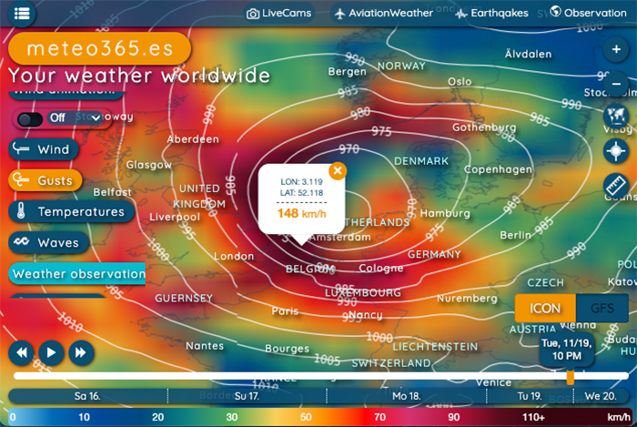
On Tuesday a storm from the North Atlantic will reach the British Isles. The center will then move towards the Netherlands and will probably also affect Germany overnight into Wednesday.
The ICON forecast includes hurricane gusts of over 140 km/h. There will also be plenty of rain, including heavy rain locally. Temperatures will fall and snowfall is also possible at higher altitudes. The storm will then move quickly towards Finland on Wednesday.Our current hourly forecast (updated 4 times a day) for your location for the next 10 days is available here on meteo365.es
Our radar with NowCast shows you what's currently happening. Where are there currently thunderstorms and precipitation and what the path will be in the next 60 minutes.
