Spain
Weather Malaga - rain again in the middle of the week

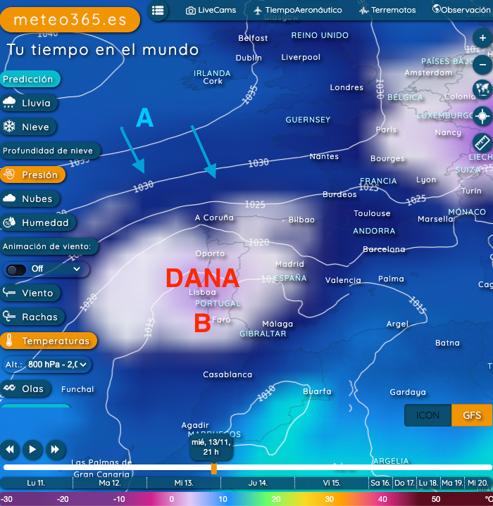
This autumn Spain is bringing one cold drop (called DANA in Spain) after another. In the coming days, rain is forecast again for the Balearic Islands, the east coast and especially for Andalusia.
According to the ICON forecast model, Malaga should have up to 150 mm of rain by the weekend. Our GFS model is predicting around 60 mm of rain. It is of course in the nature of a low pressure system that it is really very difficult to predict the precipitation, which is why the weather models are often very different. What seems certain is that the first significant snowfall will occur in the Andalusian Sierra Nevada as far as the Pardollano valley station.Our current hourly forecast (updated 4 times a day) for your location for the next 10 days is available here on meteo365.es
Our radar with NowCast shows you what's currently happening. Where are there currently thunderstorms and precipitation and what the path will be in the next 60 minutes.
meteo365.es is one of the world's leading providers of interactive weather maps. In our home market of the province of Malaga / Costa del Sol, we are by far the leading information portal for real-time weather.
Hourly measurements and daily statistics from around 800 measuring stations in Spain can be found here on meteo365.es


