Spain
Weather Spain - 2 more storms in the forecast

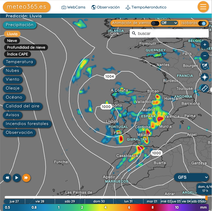
Forecast 2nd of abril 8 PM
In March, four storms ensured that Spain finally received sufficient rainfall after a long dry spell. The reservoirs are well-filled, and there is plenty of snow at higher altitudes.
Anyone who thought that the warm Spanish spring would now take over may be disappointed. In our GFS trend forecast for the next 10 days, we have two storms approaching the Iberian Peninsula. We expect the first storm on Wednesday, April 2nd, and the second on April 6th.So enjoy the few warm and sunny days we currently have.
Our current hourly forecast (updated 4 times a day) for your location for the next 10 days is available here on meteo365.es
Our radar with NowCast shows you what´s currently happening. Where are there currently thunderstorms and precipitation and what the path will be in the next 60 minutes.
meteo365.es is one of the world´s leading providers of interactive weather maps. In our home market of the province of Malaga / Costa del Sol, we are by far the leading information portal for real-time weather.
Hourly measurements and daily statistics from around 800 measuring stations in Spain can be found here on meteo365.es
Don´t miss anything and follow us on X