Spain
Weather Spain - Cold air meets warm and humid air
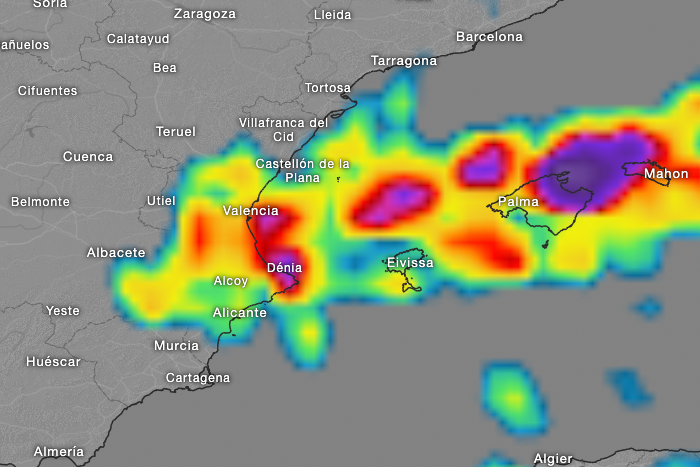
Cold air masses are flowing from the North Atlantic to the Iberian Peninsula. In eastern Spain and the Balearic Islands, there are warm and humid air masses. In the Balearic Sea, we currently have water temperatures of 27°C.
So, when cold air masses collide with warm and very humid air masses, there is a high chance of strong thunderstorms, locally with hail, heavy rain, and gusty winds.Forecast: So, in the coming days, you should be prepared for severe weather events. As of Monday midday, an orange warning level is in effect in the eastern part of the peninsula. On Tuesday, an orange warning level will be in place for the Balearic Islands and the region around Denia.
Our current hourly forecast (updated 4 times a day) for your location for the next 10 days is available here on meteo365.es
Our radar with NowCast shows you what´s currently happening. Where are there currently thunderstorms and precipitation and what the path will be in the next 60 minutes.
meteo365.es is one of the world´s leading providers of interactive weather maps. In our home market of the province of Malaga / Costa del Sol, we are by far the leading information portal for real-time weather.
Hourly measurements and daily statistics from around 800 measuring stations in Spain can be found here on meteo365.es
Don´t miss anything and follow us on X
