Valencia
Valencia weather - DANA Alice could bring 200 mm of rain locally
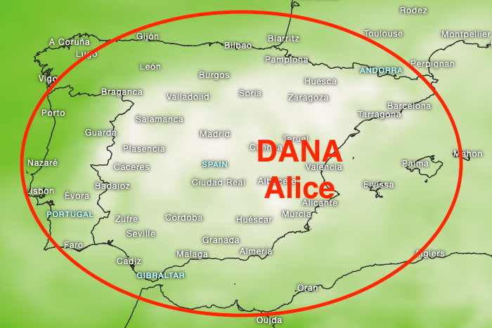
We had announced that the weather conditions in eastern Spain would change starting Wednesday evening and that a DANA (cold drop) could occur. Now it's official: DANA Alice will bring heavy rain and flooding locally from Thursday until probably Monday, especially in the autonomous region of Valencia.
We have two weather models and want to compare the forecasts for some cities:Accumulated rainfall for Denia with the GFS weather model: 83 mm of rain, ICON EU: 208 mm of rain
Accumulated rainfall for Benidorm with the GFS weather model: 58 mm of rain, ICON EU: Benidorm: 28 mm of rain
Accumulated rainfall for Valencia city with the GFS weather model: 84 mm of rain, ICON EU: 55 mm of rain
Accumulated rainfall for Cullera with the GFS weather model: 93 mm of rain, ICON EU: 235 mm of rain
Note: A forecast for a DANA (cold drop) is very complex, and you only get a reliable forecast a few hours in advance. Therefore, the current forecasts still have some uncertainty. We must therefore closely monitor the actual development, and our radar with NowCast and our NWCSAF GEO CRRPh are of course helpful in this regard.
Our current hourly forecast (updated 4 times a day) for your location for the next 10 days is available here on meteo365.es
Our radar with NowCast shows you what´s currently happening. Where are there currently thunderstorms and precipitation and what the path will be in the next 60 minutes.
meteo365.es is one of the world´s leading providers of interactive weather maps. In our home market of the province of Malaga / Costa del Sol, we are by far the leading information portal for real-time weather.
Hourly measurements and daily statistics from around 800 measuring stations in Spain can be found here on meteo365.es
Don´t miss anything and follow us on X
