Spain
Weather Spain - Heavy seas, gale-force winds, rain and snow

Storm Ingrid – Wind Forecast for Friday
Starting Thursday evening, Storm Ingrid will take hold of the Iberian Peninsula.
Ingrid will bring severe sea storms, strong winds, heavy rain and additional snowfall at lower elevations across much of the Iberian Peninsula. Along the Spanish North Atlantic coast, waves up to 9 meters high are forecast, along with severe gale-force winds exceeding 89 km/h, snow above 1,200 meters and widespread rain.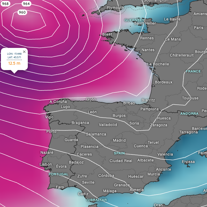
Storm Ingrid – Wave Forecast for Friday
Our current hourly forecast (updated 4 times a day) for your location for the next 10 days is available here on meteo365.es
Our radar with NowCast shows you what´s currently happening. Where thunderstorms and precipitation are occurring right now, and what their path will be over the next 60 minutes.
meteo365.es is one of the world´s leading providers of interactive weather maps. In our home market, the province of Malaga / Costa del Sol, we are by far the leading information portal for real-time weather.
Hourly measurements and daily statistics from around 800 weather stations in Spain are available here on meteo365.es