AEMET warnings for Wednesday, 16 September 2026, as of 07:25. Map: meteo365.es
Text size
Line spacing
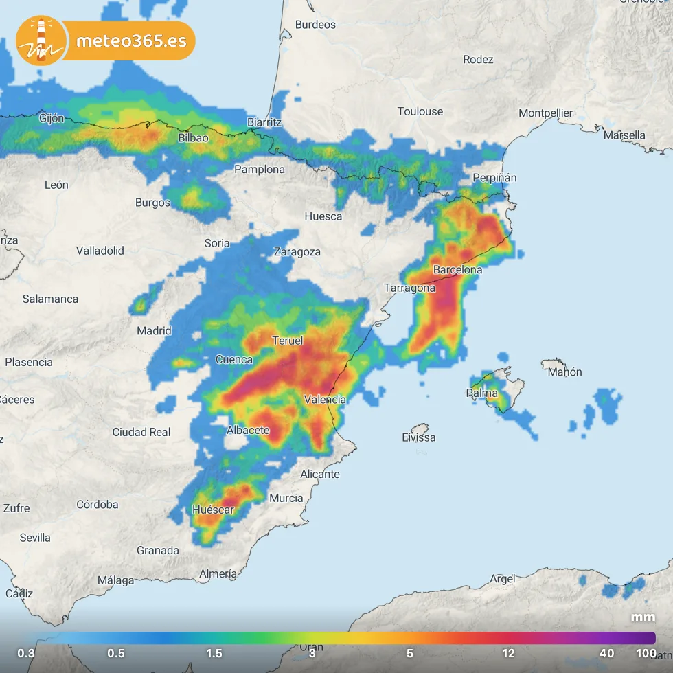
Today, the main weather concern is focused on eastern and northeastern Spain as well as Mallorca, where numerous weather warnings are in force for heavy rain and thunderstorms.
The areas requiring particular attention include Catalonia, the Valencian Community, parts of Aragón and Mallorca, while lower-level warnings also affect parts of Murcia, Castilla-La Mancha and Andalusia.
Up to 40 litres per square metre in one hour
Some of the most significant warnings affect Barcelona, Girona, Tarragona, Valencia and Castellón.
According to the current AEMET warnings, local rainfall rates of up to 40 litres per square metre in just ONE HOUR are possible.
Parts of Catalonia could see even more substantial accumulations. In areas around Barcelona, Girona and northern Tarragona, AEMET warns that rainfall totals could locally reach 100 l/m² within 12 hours — and in some locations these amounts could fall in only two or three hours.
Most of the more significant warnings begin during the afternoon, between approximately 14:00 and 18:00, and some remain active until 23:59.
Mallorca: rain warnings from 13:00
On Mallorca, rain warnings begin from around 13:00.
Parts of the island could receive around 30 l/m² within one hour, including southern Mallorca as well as the Serra de Tramuntana, interior and eastern parts of the island.
Yellow warnings from Almería to Girona
Additional warnings for heavy rainfall affect parts of Almería, Granada, Teruel, Albacete, Cuenca, Murcia, Castellón, Valencia, Girona and Tarragona.
Depending on the area, rainfall thresholds are generally between 15 and 30 l/m² in one hour.Forecast rainfall for Wednesday, 16 September 2026, in litres per square metre. ICON-EU model, 00 UTC run. Graphic: meteo365.es
What the warnings mean for this afternoon
The weather situation could deteriorate rapidly from the early afternoon onwards.
Thunderstorms can produce very large amounts of rain over a small area within a short period. This creates a local risk of flash flooding, flooded roads and underpasses, and rapidly rising streams, barrancos and ramblas.
If you're travelling today around Barcelona and the Catalan coast, Valencia, Castellón or Mallorca, keep a close eye on the latest warnings throughout the afternoon and evening.
Follow the storms live: radar with NowCast
With thunderstorms developing quickly, knowing what is happening right now can make all the difference.
Our meteo365.es RADAR distinguishes between rain, sleet, snow and hail, giving you a much clearer picture of what is actually approaching your location.Follow thunderstorms, torrential rain and potential hail cells as they develop and move across Spain.